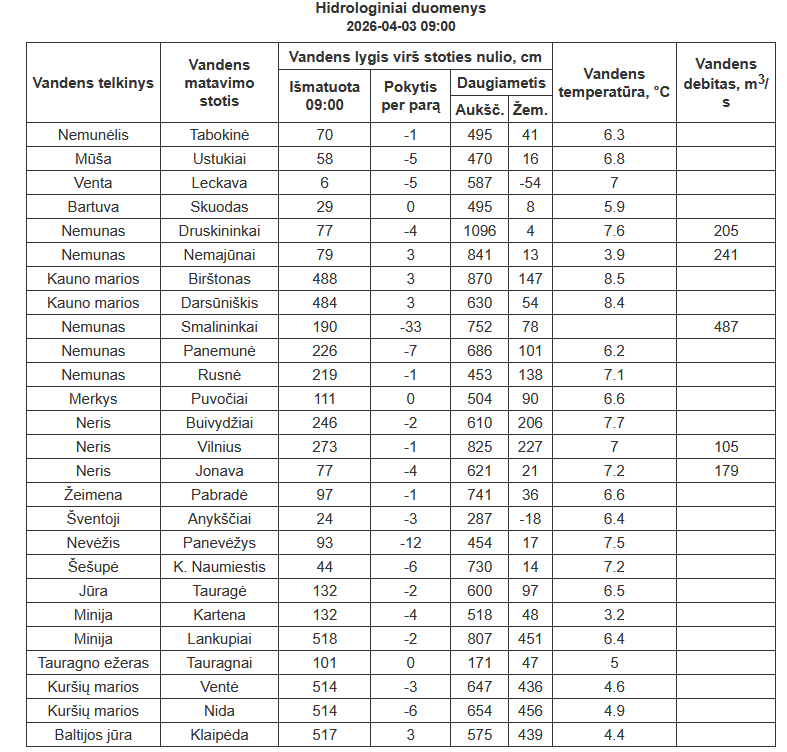
Operational hydrology network information (before data reliability is assessed). Official information can be obtained from the Hydrological Observations Division of the Lithuanian Hydrometeorological Service. The water level is given in centimeters above the zero of the water gauging station chart (the chart zero of the water gauging station is a conditional horizontal plane from which the water level is measured. It is set at approximately 0.5 m below the lowest possible water level).
Ice thickness
| Water body | Measurement date | Ice thickness, cm | Notes |
| Lake Baluošas (Ignalina Dist.) | 2026-02-17 | 39 | Frozen |
| Lake Alnis (Molėtai Dist.) | 2026-02-17 | 36 | Frozen |
| Lake Pravalas (Vilnius Dist.) | 2026-02-11 | 38 | Frozen |
| Lake Ilgis (Ignalina Dist.) | 2026-02-11 | 32 | Frozen |
| Lake Erzvėtas (Ignalina Dist.) | 2026-02-11 | 32 | Frozen |
The ice thickness is updated with each measurement. * The marked measurements were obtained from regional parks and other cooperating institutions.
